
Description
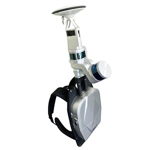
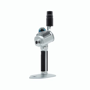
The Greenvalley LiBackpack DGC50 is a compact Lidar Scanning System featuring dual laser heads,
SLAM technology, and panoramic imaging. Capture high-precision
point cloud data fast and view results in real time.
Perfect for forestry, construction, and more—no GNSS required.
Fast & Accurate Scanning
The DGC50 delivers powerful performance across a wide range of environments.
Here’s how it ensures fast and accurate scanning:
High-Speed Capture: Dual lasers collect up to 640,000 points per second.
Long Range: Measures distances up to 120 meters.
Precision Mapping: Achieves accuracy within 5 cm.
Efficient Coverage: Maps a 2-hectare park in just 30 minutes.
Adaptable Scanning: Performs well in both open and confined areas.
Key Benefits of the Greenvalley LiBackpack DGC50
No GNSS Needed: Scan freely with SLAM.
High Accuracy: Within 5 cm.
Efficient Capture: 640,000 points/sec.
Mobile Design: Lightweight backpack.
Live Results: Instant data on mobile.
Versatile: For all mapping sectors.
Reviews
There are no reviews yet.