
Description
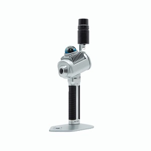
The LiGrip O1 Lite is the newest addition to GreenValley’s lightweight handheld LiGrip series,
designed with an integrated structure. It supports multiple mapping methods, including RTK-SLAM,
PPK-SLAM, and SLAM, allowing for real-time output of high-precision LAS point cloud data in true color,
complete with absolute coordinates. The device can also be paired with an RTK module and telescopic pole,
making it ideal for tasks like floor plan creation, mine and stockpile surveys, as well as facade measurements.
When used in conjunction with LiDAR360 and LiDAR360MLS software,
it delivers an efficient, all-in-one solution for customers.
Reviews
There are no reviews yet.